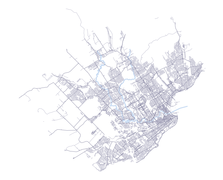
How long would it take to walk every street in Québec?

How many streets does Québec have?
Québec has 3,876 km of walkable streets and paths, across 4,831 named streets. Walking 5 km a day, it would take at least 776 days (about 2 years) to walk every one of them.
Covers the area inside the official Québec boundary on OpenStreetMap. Last updated 4 October 2026.
Every street walked once, 5 km a day. Real walks double back, so the true number is a little higher.
Québec is the 175th biggest of the 576 cities on Untrod by length of streets. About 23% of it is paths, footways and steps, close to the 19% of a typical city. Along the way there are 163 landmarks to collect as stamps.
Your pace
The same streets at a different speed.
What’s the longest street in Québec?
19.1 km inside Québec
17.9 km, then Boulevard Louis-XIV at 13.8 km
There are 3 separate streets called Rue Saint-Paul
Landmarks to collect
163 stamps in Québec. Each one is added to your map when you walk past.
Put it in perspective
Cities like Québec
Nearby, and about the same size.
Questions
What counts as a street?
Every street, lane and path in OpenStreetMap that you’re allowed to walk on, named or not: residential streets, main roads, footways, park paths and steps. Motorways, private roads, driveways and car parks are left out, and so are pavements drawn as separate lines, because walking one already counts for the street beside it.
Why “at least”?
The number assumes you walk each street once, with no doubling back and no walk to get there. Real walks overlap, so it will take a little longer.
Where does the data come from?
From OpenStreetMap, a map of the world made by volunteers. Québec’s streets were last updated in October 2026.
What if a street is missing?
Anyone can add it to OpenStreetMap. It will appear here, and on your map in Untrod, after the next update.
How does Untrod track it?
Untrod for iPhone records your location during a walk, and only then, and colours in each street you walk along. Your map is only visible to you until you choose to share it.
Add this number to your site
A small card that links back to this page. Pick the version that suits your site.
<iframe src="https://untrod.app/embed/quebec-city?theme=light" width="400" height="220" style="border:0" title="776 days to walk every street in Québec"></iframe>
<p style="margin:4px 0 0;font:13px/1.4 sans-serif"><a href="https://untrod.app/streets/quebec-city">776 days to walk every street in Québec</a> · Untrod</p>